Georeactor Blog
RSS FeedTravel Research for Sumatra
This post will be unusual - I haven't visited Sumatra yet, but I started researching after visiting the Riau Islands, Makassar in Sulawesi, and Surabaya and Tawangmangu in Java last year.
Background
Sumatra is an island about the size of California. Here's an ethnographic map showing the location respective to the Malay peninsula and Java (CC-BY-SA Wikipedia / Indonesian National Museum)
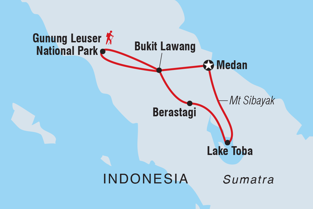
Foreign tourists usually arrive in Medan, then visit Lake Toba and an orangutan preserve in the northwest - here's a typical 'Sumatra Adventure Itinerary':
I started thinking about a more comprehensive Sumatra trip. I wanted to transit north-south or south-north. After browsing OpenRailwayMap, I considered riding every passenger rail network in Sumatra while on that journey. This would be a neat YouTube topic.
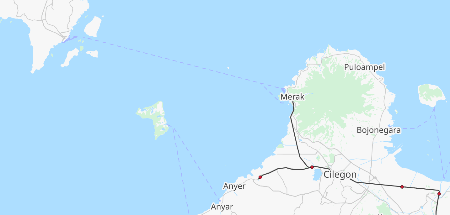
Suppose I fly into Indonesia's main international airport in Jakarta. That's on the island of Java. I could take a bus or train west, and then cross the Sunda Strait. Google Maps estimates two hours on a bus, one hour on a ferry.
There isn't a lot built up at the landing point, or on that cape pointing south. So probably the next step would be catching a bus to Bandar Lampung, the main city of the province.
This is relatively close to Way Kambas National Park, which has tigers, elephants, and maybe a dozen rhinos. There isn't a lot of infrastructure inside the park, and it was closed to tourists for a while (no TripAdvisor reviews from 2020 until November 2024).
Here's a video from June of an itinerary from Jakarta to Way Kambas. He rides a motor scooter for the last segment, visits a homestay, and then does an offroad elephant tour: https://www.youtube.com/watch?v=ohd9QZz3c04&t=2445s
There is concern about the treatment of the elephants tethered close to the visitors center. From TikTok it looks like people feed and touch baby elephants https://www.tiktok.com/place/Way-Kambas-National-Park-21568226270036286
More wild tours are available https://www.tiktok.com/@explore_waykambas/video/7465885447567232262
Trains
From Bandar Lampung, there are two train routes, one to Lubuklinggau, the other to Palembang.
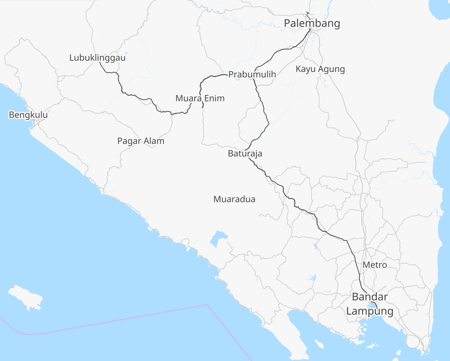
Palembang is a larger city (and the name of an ethnic group). There's a light rail open since 2018 for the Asian Games: https://en.wikipedia.org/wiki/Palembang_LRT which I should include in my project. WikiTravel says the signature food is pempek, a "fried fishcake […] eaten with a spicy dips called cuko".
I don't have much info on Lubuklinggau; I assume most travelers are going to Bengkulu on the west coast?
There are some mini cars on rails (Motor Lori Ekspress) in a mining area in the jungle north of Bengkulu. I think you'd need to book a driver/guide for a day or two, etc. to see this. https://www.youtube.com/watch?v=vYM3aXwsarM
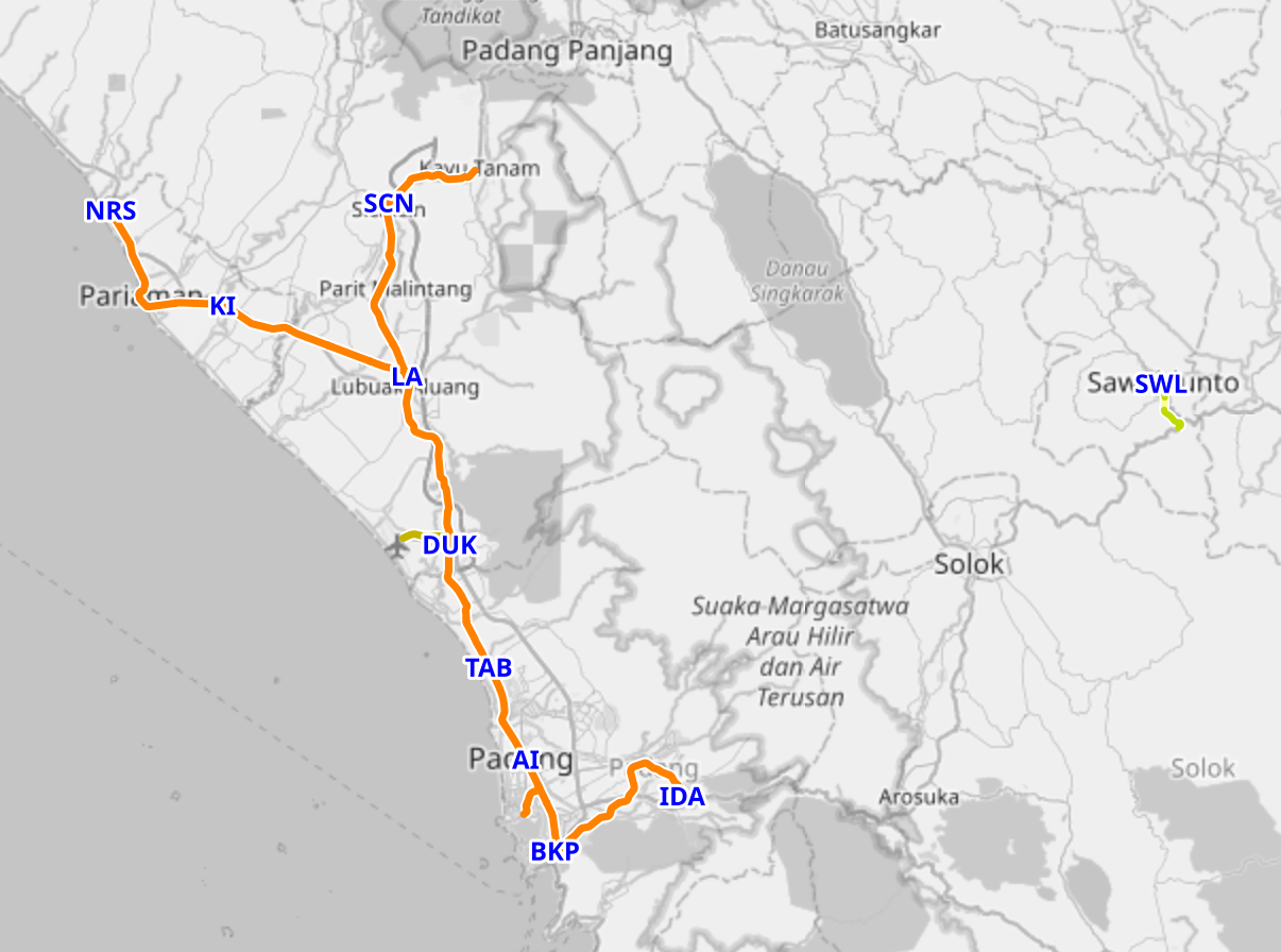
The next passenger railway network is a 17 hour bus north in Padang. It's a semi popular city to visit and there are hiking/camping tours in nearby national parks.
Further inland there is a railway marked around Sawahlunto (SWL). This is mostly a railway museum but they have restored a "Mak Itam" steam train for tourists. There are videos of the train moving in 2023 and 2024, but it looked like a special event, and a recent Google Maps review says it "will soon be reactivated". Someone is posting generative AI videos / narration about the train and mining history https://www.youtube.com/@buyuang_palala/videos
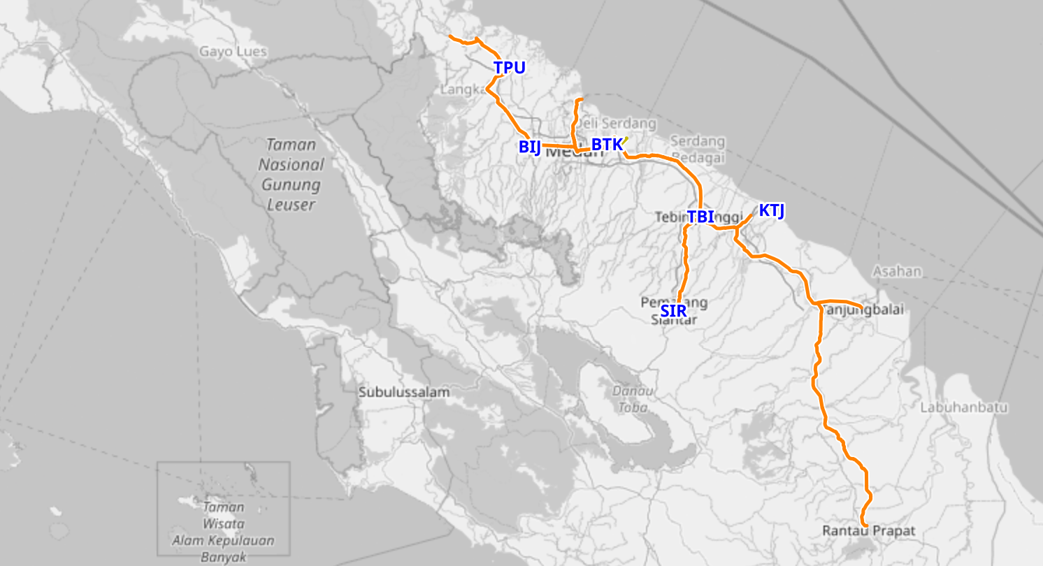
Leave the west coast on a 16-hour bus from Padang north to Rantauprapat, to join the railway network around Medan. This doesn't go to Lake Toba and tourist destinations, but it is big compared to the other segments. The map exaggerates a bit, as the northwestern line closed in 2008 and since reopening in 2022 terminates in Kuala Bingai.
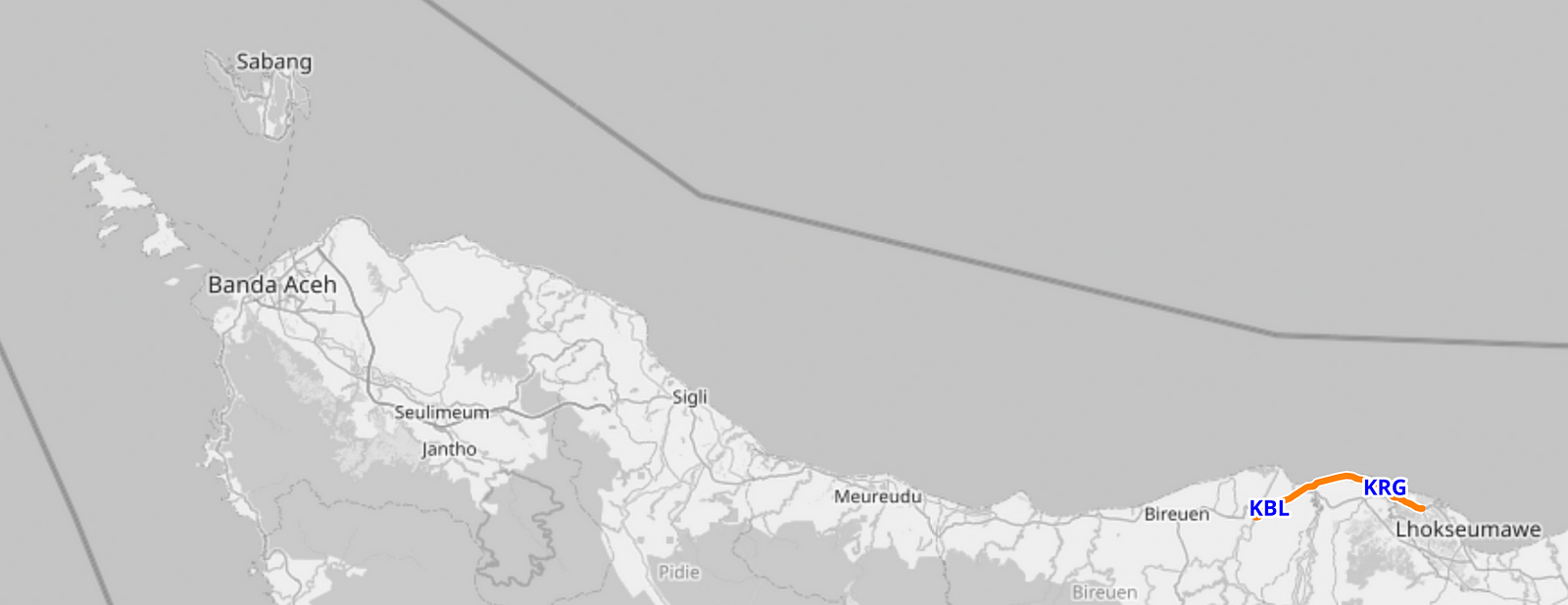
The final passenger rail segment is Cut Meutia, a 14-mile segment limited to the eastern part of Aceh. This opened in 2016 with a new station opening in 2023. Wikipedia is rather vague about why this exists, stating "Due to its low fare and short travel distance, it is commonly used by locals as a recreational vehicle, especially by schoolchildren". Part of the track was built by the French after the 2004 tsunami.
Island retreats
If I finish the Sumatra trip in Aceh, it'd be good to look for a retreat at the end of the road. The capital is not a typical tourist destination because the province has strict Islamic law.
There's a ferry connection to the island of Sabang. They have a large 'kilometer 0' monument. One comment on Google Maps reads "You haven't been to Sabang if you haven't bought AG Sabang Green Bean Cake". Popular kayak spot with Indonesian tourists: https://www.instagram.com/sabangkayak/
On the west coast, at the southern border of Aceh, the West Banyak Islands are a hot destination. I found one tourist account ( https://where2.site/2017/10/31/kayaking-the-banyak-islands/ ) which is detailed and gives tourist tips (if you kayak between islands, it is the open sea, and it seems important to be an experienced swimmer or to bring a guide). Kimo Resort has an Instagram: https://www.instagram.com/kimoresort
I did some Googling of other islands. Nias and Bangka have some resorts and beaches, but there don't seem to be many 'attractions'.
Language and Diversity
Bahasa Indonesia is seen as the 'lingua franca'. But do people speak it at home? It depends:
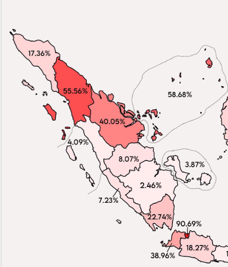
The Malay language was core to the Johor-Riau Sultanate and Riau-Lingga Sultanate which is why you'll see such high numbers in northern Sumatra and the Riau Islands there (I assume we're counting all forms of Malay as Bahasa speakers here, idk). The Surabaya region has a really low % Bahasa and I was able to use my Duolingo words there, so the map might not matter, but it is a little interesting.
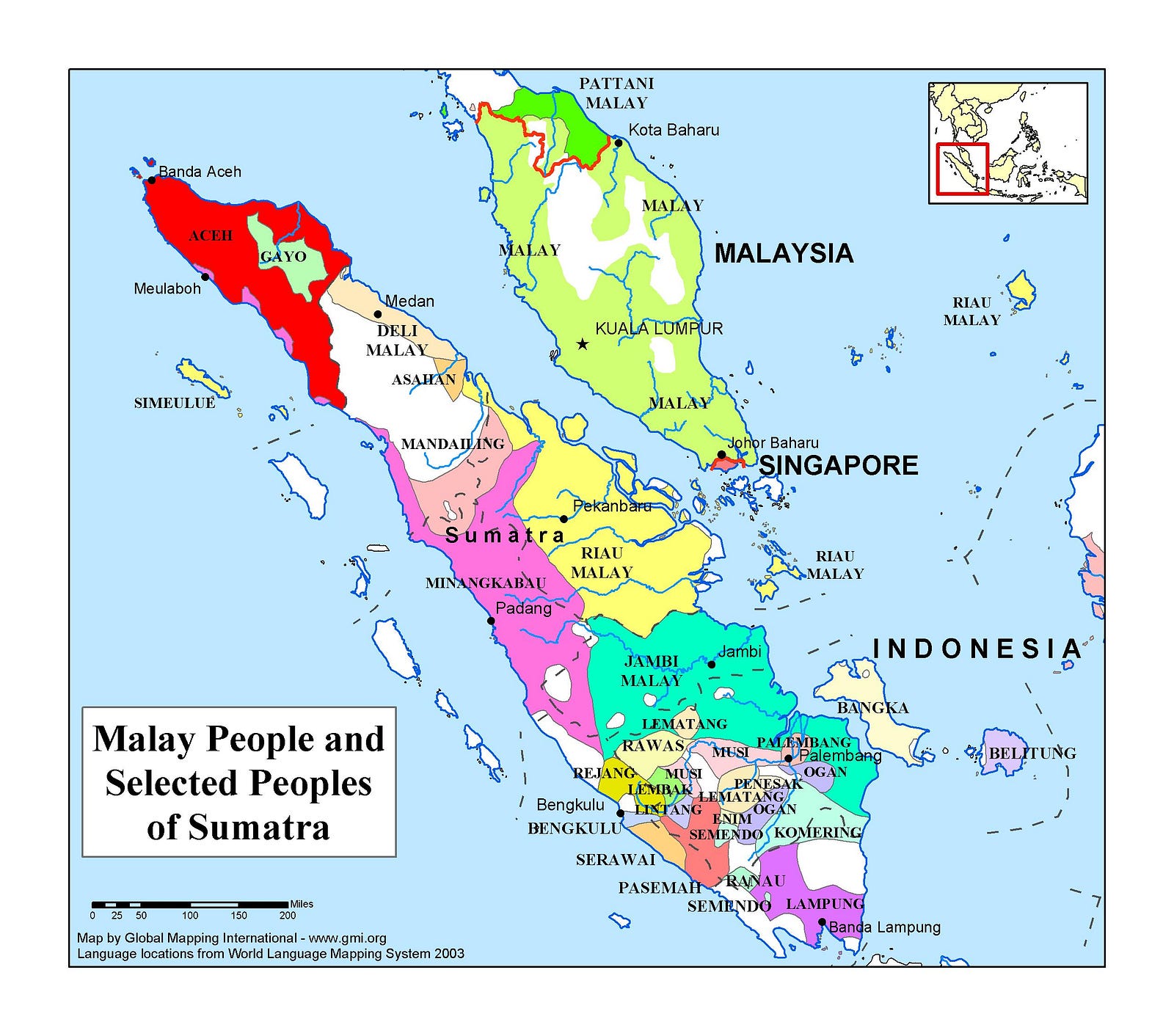
The next map, which I found on a Christian missionary site, shows that southern fork rail area between Lampung, Palembang, and Bengkulu has multiple ethnic groups. In the north, this agrees with the prior info with Aceh/Acehnese and Riau Malay being the major groups up there.
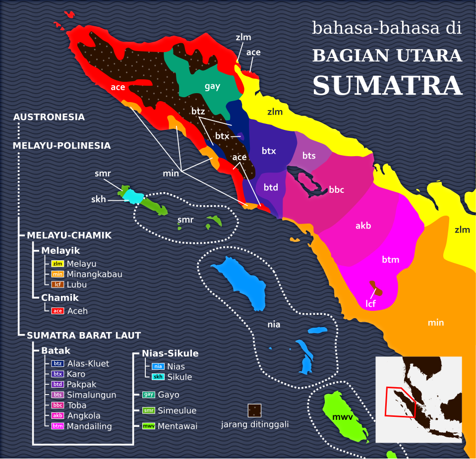
Wikipedia has a different map of North Sumatran languages. A lot more colors, but I would say these are… mostly in agreement? Except that this map has filled in the white inland area with a line of Batak languages.
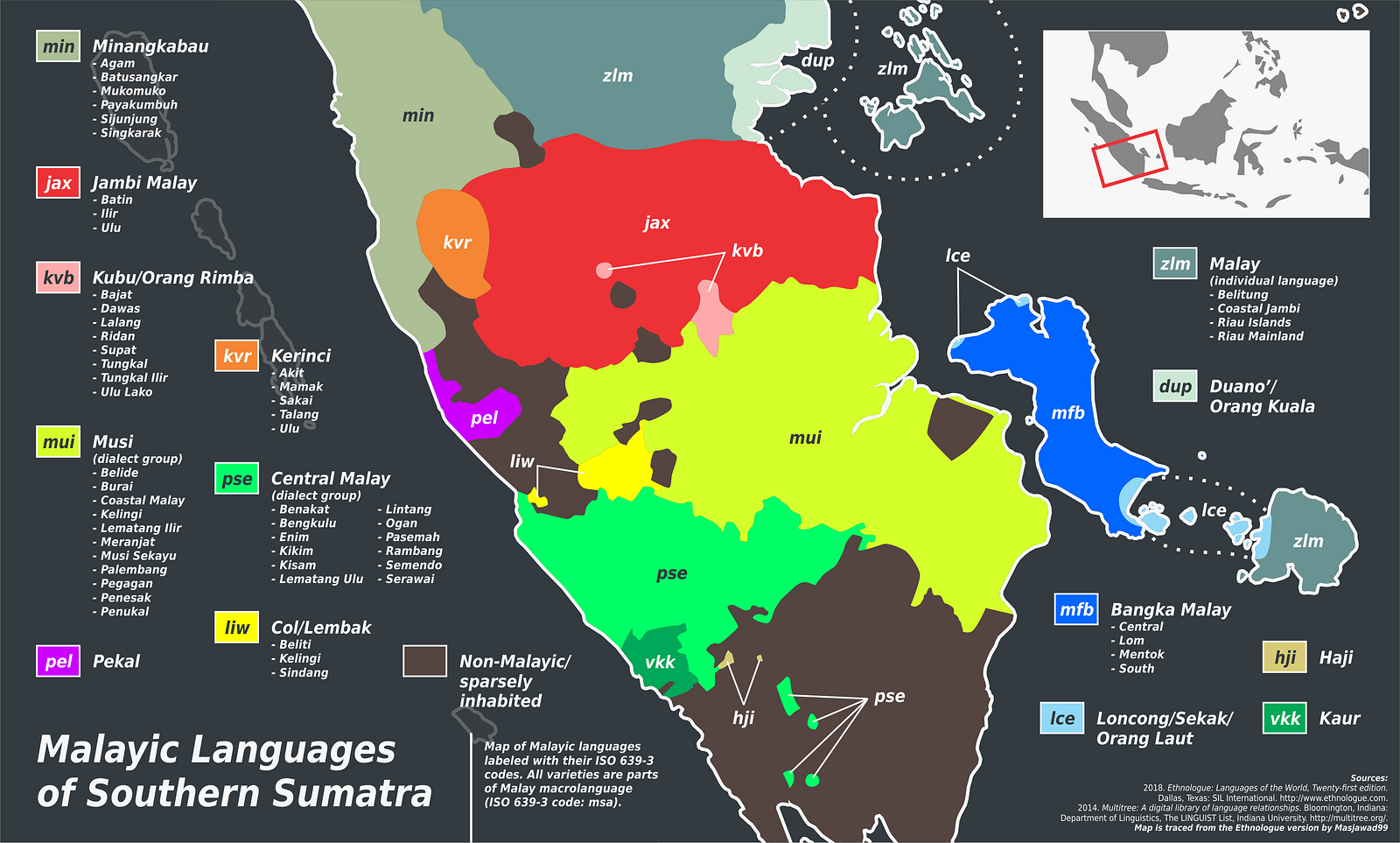
This last map of Southern Sumatra is less clear. They are putting Bengkulu as 'Central Malay' and Bangka Island is 'Bangka Malay' even though those areas scored very low on the Bahasa-at-home map. And then the southern tip (Lampung) isn't broken down.